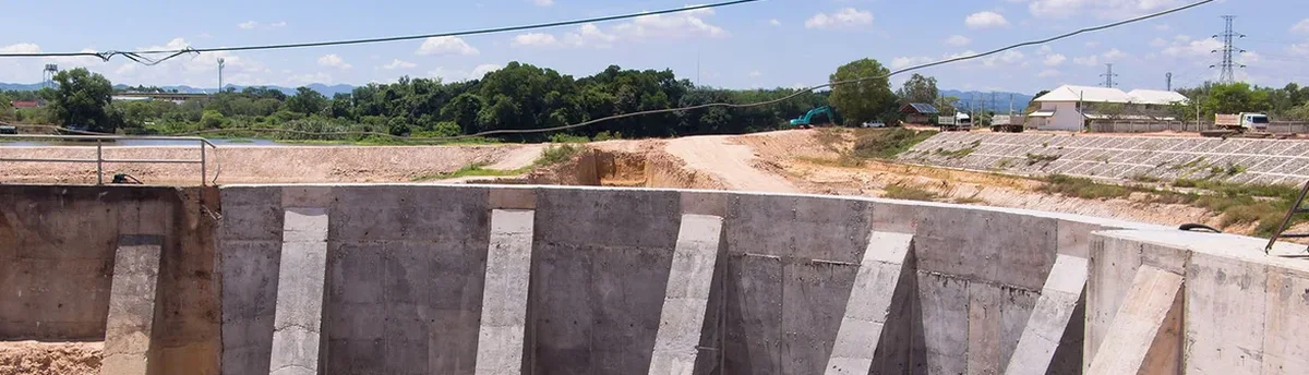
The telltale sign of a properly monitored excavation in Edmonton is that yellow PVC standpipe sticking out of the ground, the one with the inclinometer cable snaking into a readout unit. That tube tells a story of millimetre-scale movements happening twenty metres below street level. Our team deploys these instruments in the North Saskatchewan River valley formations and the stiff glacial till that defines much of the city's subsurface. Between the downtown tower projects and the LRT expansions, Edmonton's construction profile demands a monitoring approach that can handle freeze-thaw cycles, overconsolidated clays, and the occasional artesian condition in buried preglacial channels. When you are going down three or four parking levels next to a century-old building on Jasper Avenue, the conversation stops being about whether to monitor and becomes about how many data points per day you need. We combine traditional manual readings with automated inclinometer arrays and settlement cells that push data to the engineer's phone before the morning site meeting.
An inclinometer casing that shows zero lateral deflection for three consecutive weeks in Edmonton till is either installed in bedrock or the battery on the probe is dead.
Scope of work in Edmonton
Demonstration video
Typical technical challenges in Edmonton
Edmonton can swing from minus thirty in January to a chinook melt in February within a single week. That thermal shock matters for excavation monitoring because the top two metres of ground freeze solid, creating a rigid crust that masks movement in the instruments below. A reading that looks stable at the surface can hide a developing slip plane at depth. Our approach accounts for seasonal stiffening by referencing deep inclinometer zones against a fixed datum in unfrozen till, and by interpreting crack gauge data alongside temperature logs. In the river valley, where many high-end residential excavations cut into the Saskatchewan Sands and Gravels, water inflow can destabilize the face within hours. We have learned to install real-time piezometric alarms in those settings, tying the trigger levels directly to the contractor's emergency response plan.
Our services
We provide a full instrumentation package that goes beyond placing a few settlement points on the sidewalk. Our Edmonton monitoring work covers the entire lifecycle of the excavation, from pre-construction condition surveys to post-backfill verification readings.
Inclinometer installation and reading
Casing installed through overburden into stable till or bedrock. Readings taken with a digital MEMS probe and plotted as cumulative deflection versus depth, with alarm thresholds flagged per the engineer's specification.
Piezometric and groundwater monitoring
Vibrating wire piezometers grouted into discrete zones within the till or sand layers. Data loggers upload readings hourly, with SMS alerts if pore pressure exceeds the dewatering system's design capacity.
Crack and vibration surveys
Pre-construction condition documentation on all adjacent structures within the zone of influence, including Avongard crack gauges, photogrammetric records, and triaxial geophone monitoring during rock removal.
Automated total station networks
Robotic total stations tracking prism targets on shoring, adjacent buildings, and utility bridges. Data is processed overnight and delivered as a web-based report showing 3D displacement vectors and rate-of-change graphs.
Frequently asked questions
How much does excavation monitoring cost for a typical Edmonton infill project?
For a single-family infill excavation with one inclinometer casing, two piezometers, and monthly readings over a six-month construction period, budgets typically run between CA$1,100 and CA$3,690. The spread depends on access conditions in older neighborhoods like Westmount or Glenora, whether we are monitoring a neighboring heritage home, and the reporting frequency the engineer requires.
When does the City of Edmonton require a monitoring program?
The requirement usually comes from the geotechnical engineer of record rather than the city directly, but Edmonton's permitting process will flag any excavation deeper than three metres adjacent to a public right-of-way or an existing building. The Drainage Bylaw also triggers the need for a pre-construction condition survey if dewatering could influence settlement on neighboring properties.
What instruments do you use in glacial till versus river valley sands?
In glacial till we rely heavily on inclinometers and standpipe piezometers because the low permeability gives us time to react to pressure changes. In the Saskatchewan Sands and Gravels of the river valley, we add vibrating wire piezometers with real-time telemetry and automated total station prisms because the material can drain quickly and deform with little warning once the water table is breached.
How do you handle monitoring during Edmonton's winter months?
Frost penetration here can exceed two metres in an open excavation. We protect inclinometer casings with insulated enclosures and extend the bottom of the casing well below the frost zone. Crack gauges on adjacent buildings are read alongside temperature sensors so we can separate thermal expansion and contraction of the structure from real excavation-induced movement.