Edmonton sits on a complex layering of glacial till, sand channels, and Cretaceous bedrock, and while the region is far from active plate boundaries, the 2013 M4.8 Brazeau Dam event reminded everyone that moderate seismicity can still shake the prairies. Seismic microzonation here is not about finding the next big fault; it is about understanding how the shallow surficial geology—particularly the thick, variable Lake Edmonton sands and the underlying glacial till—amplifies ground motion differently across a single property. For developers planning mid-rise structures in the downtown core or industrial expansions near the Anthony Henday ring, a site-specific MASW survey provides the VS30 measurements that feed directly into a microzonation map, revealing which corners of a parcel could experience higher shaking intensity under the NBCC 2020 seismic hazard model.
In Edmonton, two boreholes a hundred meters apart can sit on different seismic site classes—microzonation maps that hidden boundary before excavation starts.
Scope of work in Edmonton
Typical technical challenges in Edmonton
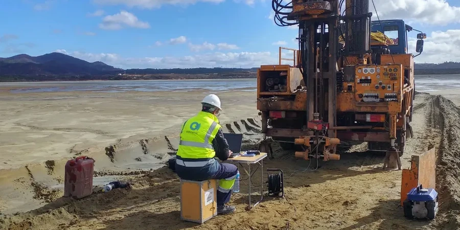
The field crew deploys a 24-channel seismograph with 4.5 Hz geophones across the site—often working around frozen ground in early spring or dodging summer thunderstorms that sweep off the Rockies—to capture surface wave dispersion down to 30 m or more. The primary risk in Edmonton’s microzonation work is not the seismic hazard itself but the misinterpretation of soft, saturated sand lenses as stable ground. A site class D assumption across the whole parcel, when a buried channel of loose sand actually behaves as Site E, can shift the design spectral acceleration by 30% or more. The microzonation map eliminates that blind spot, giving the structural team a grid of response spectra that reflects real stratigraphy: stiff till here, softer lacustrine clay there, and the transition zone in between. For critical infrastructure—water treatment plants along the North Saskatchewan, data centers in the southeast industrial district—this spatial resolution is the difference between a resilient design and an expensive post-earthquake retrofit.
Our services
Our Edmonton seismic microzonation studies are built around the specific regulatory and geological conditions of the Alberta prairies, delivering actionable maps rather than generic reports.
VS30 Mapping and Site Classification
High-resolution VS30 profiling using active and passive MASW, calibrated to borehole logs, to assign NBCC site classes on a grid across your development area. We handle irregular parcel shapes, variable terrain in the river valley, and the transition zones between bedrock highs and deep till.
Design Ground Motion Maps
Full site response analysis producing contour maps of PGA, Sa(0.2), and Sa(1.0) at foundation level. Includes one-dimensional wave propagation modeling for each representative soil column and aggregation into a microzonation report suitable for peer review and City of Edmonton permit submission.
Questions and answers
What is the typical cost range for a seismic microzonation study in Edmonton?
How does microzonation differ from a standard NBCC site class determination?
A standard NBCC site class assigns a single classification (A through E) to the entire site based on an average VS30 or a representative borehole. Microzonation subdivides the property into zones, each with its own design response spectrum. This captures lateral changes in soil stiffness—for example, a buried sand channel crossing one corner of the lot—so each building footprint or infrastructure segment sees the correct seismic demand instead of a single, potentially unconservative envelope.
How long does a microzonation study take to complete from field work to final report?
For a typical Edmonton commercial or industrial site, expect the field acquisition to take two to five days depending on grid density. Laboratory processing of surface wave data, borehole correlation, and site response modeling usually requires three to four weeks. The final report with ground motion maps and NBCC-compliant design spectra is delivered within five to six weeks of mobilization, though timelines can extend if winter drilling or frozen-ground delays occur.